Dogmarsh Bridge
Introduction
The photograph on this page of Dogmarsh Bridge by Derek Harper as part of the Geograph project.
The Geograph project started in 2005 with the aim of publishing, organising and preserving representative images for every square kilometre of Great Britain, Ireland and the Isle of Man.

There are currently over 7.5m images from over 14,400 individuals and you can help contribute to the project by visiting https://www.geograph.org.uk
Dogmarsh Bridge
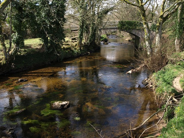
Image: © Derek Harper Taken: 5 Apr 2009
Looking upstream towards Image, which dates from 1840. The River Teign is the parish boundary between Chagford and Drewsteignton, which is why you will find two descriptions of the bridge on Images of England: http://www.imagesofengland.org.uk/Details/Default.aspx?id=94827&mode=adv and http://www.imagesofengland.org.uk/Details/Default.aspx?id=94547&mode=adv . These suggest than an earlier bridge was upstream.
Images are licensed for reuse under creativecommons.org/licenses/by-sa/2.0
Image Location
Latitude
50.689344
Longitude
-3.823359