Cottages at Coalbrookdale with Holy Trinity Church behind.
Introduction
The photograph on this page of Cottages at Coalbrookdale with Holy Trinity Church behind. by Anji Carrier as part of the Geograph project.
The Geograph project started in 2005 with the aim of publishing, organising and preserving representative images for every square kilometre of Great Britain, Ireland and the Isle of Man.

There are currently over 7.5m images from over 14,400 individuals and you can help contribute to the project by visiting https://www.geograph.org.uk
Cottages at Coalbrookdale with Holy Trinity Church behind.
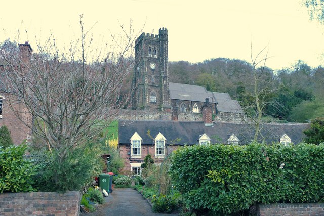
Image: © Anji Carrier Taken: 5 Apr 2009
These cottages with gabled semi-dormers are along Wellington Road at Coalbrookdale next to the Foundry Master's house. Holy Trinity church is seen behind them, which has many associations with the foundry, but sits within the neighbouring geo grid square.
Images are licensed for reuse under creativecommons.org/licenses/by-sa/2.0
Image Location
Latitude
52.636785
Longitude
-2.489362