Highroad Well Moor, Ovenden
Introduction
The photograph on this page of Highroad Well Moor, Ovenden by Humphrey Bolton as part of the Geograph project.
The Geograph project started in 2005 with the aim of publishing, organising and preserving representative images for every square kilometre of Great Britain, Ireland and the Isle of Man.

There are currently over 7.5m images from over 14,400 individuals and you can help contribute to the project by visiting https://www.geograph.org.uk
Highroad Well Moor, Ovenden
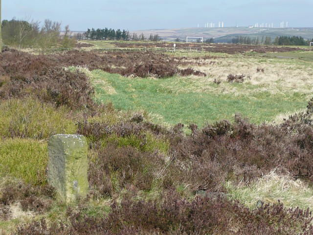
Image: © Humphrey Bolton Taken: 2 Apr 2009
Part of this area has been made into football pitches. The moorland adjoined Warley Common, and the stone in the foreground marks the boundary; W on the side in view and O on the other side.
Images are licensed for reuse under creativecommons.org/licenses/by-sa/2.0
Image Location
Latitude
53.72767
Longitude
-1.915087