Rackham
Introduction
The photograph on this page of Rackham by Simon Carey as part of the Geograph project.
The Geograph project started in 2005 with the aim of publishing, organising and preserving representative images for every square kilometre of Great Britain, Ireland and the Isle of Man.

There are currently over 7.5m images from over 14,400 individuals and you can help contribute to the project by visiting https://www.geograph.org.uk
Rackham
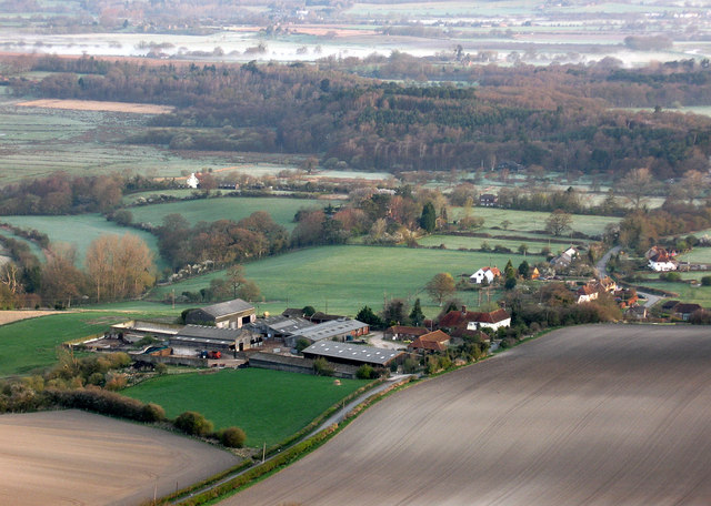
Image: © Simon Carey Taken: 5 Apr 2009
View of the small hamlet from Rackham Hill about half an hour after sunrise. Rackham Farm is on the left with the wooded commons of Rackham, Greatham, Washingham and Sparrite to the north followed by the mist shrouded River Arun.
Images are licensed for reuse under creativecommons.org/licenses/by-sa/2.0
Image Location
Latitude
50.913214
Longitude
-0.506937