Polythene 'stripes' near Whitchurch
Introduction
The photograph on this page of Polythene 'stripes' near Whitchurch by Espresso Addict as part of the Geograph project.
The Geograph project started in 2005 with the aim of publishing, organising and preserving representative images for every square kilometre of Great Britain, Ireland and the Isle of Man.

There are currently over 7.5m images from over 14,400 individuals and you can help contribute to the project by visiting https://www.geograph.org.uk
Polythene 'stripes' near Whitchurch
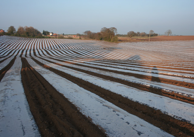
Image: © Espresso Addict Taken: 2 Apr 2009
A large arable field north east of Whitchurch has been treated with polythene, presumably to protect recently planted seedlings; the resultant 'stripes' highlight the undulations in the ground. The foreground is in this gridsquare; the middle distance is in Image; the buildings (far distance) are Mile Bank Farm (far left) and a former factory (centre left and centre) in Image This view is north east; the view south east is shown in Image
Images are licensed for reuse under creativecommons.org/licenses/by-sa/2.0
Image Location
Latitude
52.979736
Longitude
-2.673145