Church of St. Blaise, St. Blazey, Cornwall
Introduction
The photograph on this page of Church of St. Blaise, St. Blazey, Cornwall by Dr Neil Clifton as part of the Geograph project.
The Geograph project started in 2005 with the aim of publishing, organising and preserving representative images for every square kilometre of Great Britain, Ireland and the Isle of Man.

There are currently over 7.5m images from over 14,400 individuals and you can help contribute to the project by visiting https://www.geograph.org.uk
Church of St. Blaise, St. Blazey, Cornwall
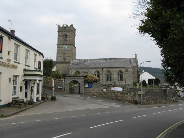
Image: © Dr Neil Clifton Taken: 1 Apr 2009
This church, built in 1842, stands in a prominent position on the north side of the A390 opposite the junction with Station Road. The 'Cornish Arms' is seen to the left.
Images are licensed for reuse under creativecommons.org/licenses/by-sa/2.0
Image Location
Latitude
50.361511
Longitude
-4.71712