West Vale Mills
Introduction
The photograph on this page of West Vale Mills by Chris Allen as part of the Geograph project.
The Geograph project started in 2005 with the aim of publishing, organising and preserving representative images for every square kilometre of Great Britain, Ireland and the Isle of Man.

There are currently over 7.5m images from over 14,400 individuals and you can help contribute to the project by visiting https://www.geograph.org.uk
West Vale Mills
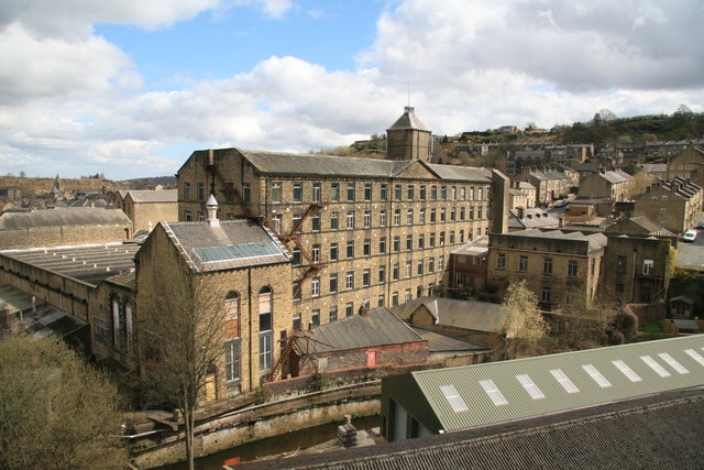
Image: © Chris Allen Taken: 4 Apr 2009
Still in use. The photo shows the main pedimented block, fine stair tower, weaving shed and two engine houses in the bottom left corner.
Images are licensed for reuse under creativecommons.org/licenses/by-sa/2.0
Image Location
Latitude
53.686
Longitude
-1.857784