Wendover Arm: The Water Flow Gauge
Introduction
The photograph on this page of Wendover Arm: The Water Flow Gauge by Chris Reynolds as part of the Geograph project.
The Geograph project started in 2005 with the aim of publishing, organising and preserving representative images for every square kilometre of Great Britain, Ireland and the Isle of Man.

There are currently over 7.5m images from over 14,400 individuals and you can help contribute to the project by visiting https://www.geograph.org.uk
Wendover Arm: The Water Flow Gauge
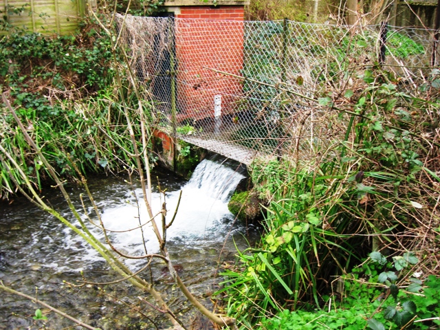
Image: © Chris Reynolds Taken: 25 Mar 2009
Water flow into the Canal has been measured since 1844 – and the records provide one of the longest continuous records of water flow in the world. See Image
Images are licensed for reuse under creativecommons.org/licenses/by-sa/2.0
Image Location
Latitude
51.766005
Longitude
-0.741125