Carnon River pollution
Introduction
The photograph on this page of Carnon River pollution by John Gibson as part of the Geograph project.
The Geograph project started in 2005 with the aim of publishing, organising and preserving representative images for every square kilometre of Great Britain, Ireland and the Isle of Man.

There are currently over 7.5m images from over 14,400 individuals and you can help contribute to the project by visiting https://www.geograph.org.uk
Carnon River pollution
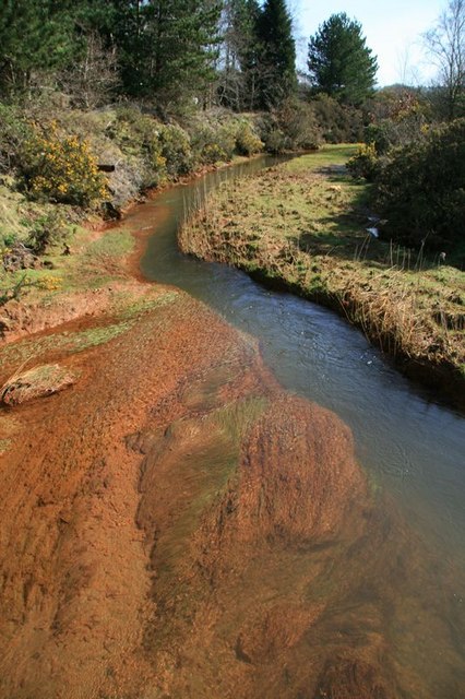
Image: © John Gibson Taken: 17 Mar 2009
The Carnon River is heavily polluted with iron hydroxides and a mix of heavy metals, a legacy of the intensive metal mining in this area, which has what is reported to be the highest ground arsenic count in the world. The impact is clear at this point in the river, although a variety of river grasses and plants seem to be happy enough in spite of the pollutants.
Images are licensed for reuse under creativecommons.org/licenses/by-sa/2.0
Image Location
Latitude
50.228842
Longitude
-5.121002