Slough: Salt Hill Park subway
Introduction
The photograph on this page of Slough: Salt Hill Park subway by Nigel Cox as part of the Geograph project.
The Geograph project started in 2005 with the aim of publishing, organising and preserving representative images for every square kilometre of Great Britain, Ireland and the Isle of Man.

There are currently over 7.5m images from over 14,400 individuals and you can help contribute to the project by visiting https://www.geograph.org.uk
Slough: Salt Hill Park subway
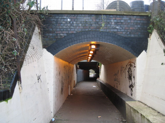
Image: © Nigel Cox Taken: 8 Jan 2009
The subway links Salt Hill Park and Baylis Road under the former Great Western Railway's main line. There are actually two subways here. The far one is the earlier and still carries the main line. The nearer one was built to accommodate a head shunt for the sidings serving Image The trackwork has however long since been removed from this. However the original, and still continuing function, of this hole through the railway embankment was to allow the passage of Salt Hill Stream, which is now culverted itself under the subway.
Images are licensed for reuse under creativecommons.org/licenses/by-sa/2.0
Image Location
Latitude
51.515141
Longitude
-0.606384