Railway Wharf
Introduction
The photograph on this page of Railway Wharf by Simon Carey as part of the Geograph project.
The Geograph project started in 2005 with the aim of publishing, organising and preserving representative images for every square kilometre of Great Britain, Ireland and the Isle of Man.

There are currently over 7.5m images from over 14,400 individuals and you can help contribute to the project by visiting https://www.geograph.org.uk
Railway Wharf
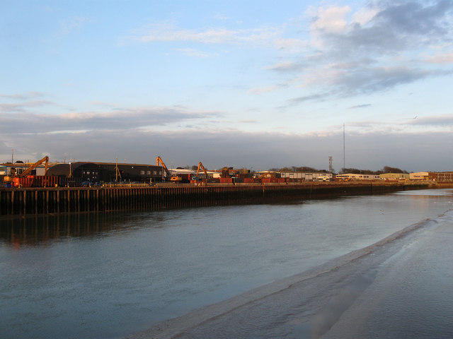
Image: © Simon Carey Taken: 29 Mar 2009
This wharf has a long history, cross channel packets operated from here between 1788-1847 until the LBSCR, who had recently purchased the service, decided to move to Newhaven after being unable to agree terms with the harbour authorities. The first wharf was built in the 1840s with a set of sidings to join it to the nearby railway line and for many years was the main wharf for coal traffic. It was redesigned in 1938 which involved filling in basins and leaving a straight frontage along the Adur. With goods traffic falling and the council wanting to improve the nearby A259 which crossed the railway on a narrow bridge the sidings were pulled up in 1968 and with it went the coal yard. However in 1981 the wharf began to be used for aggregates and the production of concrete until that too ceased in 1996. Since then there have been growing battles between the residents south of the water in Shoreham Beach and the planners about use of the wharf, in the last few years a concrete batch processing plant, an extension of the breakers yard and a waste facility have all been rejected by vociferous protests of those this side the river. Consequently, much of the wharf remains unused.
Images are licensed for reuse under creativecommons.org/licenses/by-sa/2.0
Image Location
Latitude
50.831595
Longitude
-0.256772