The Punchbowl, Crookes
Introduction
The photograph on this page of The Punchbowl, Crookes by Dave Hitchborne as part of the Geograph project.
The Geograph project started in 2005 with the aim of publishing, organising and preserving representative images for every square kilometre of Great Britain, Ireland and the Isle of Man.

There are currently over 7.5m images from over 14,400 individuals and you can help contribute to the project by visiting https://www.geograph.org.uk
The Punchbowl, Crookes
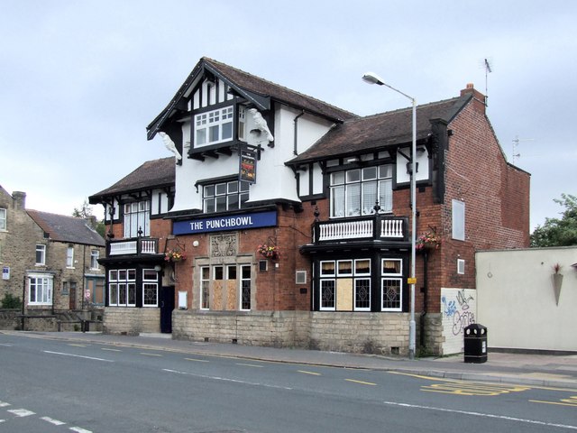
Image: © Dave Hitchborne Taken: 26 Aug 2008
The pub stands at the corner of Crookes and Springvale Road. In the years that I remember it, there was a snooker room to the right of the building. A doorway facing Springvale Road led to an off-sales where customers would go and buy cigarettes, bottled drinks or even take a jug and get it filled with beer. A toothless old grandma would walk down Toftwood Road, come Sunday, resplendent in beret, with strands of wispy grey hair splaying out. She always had on a long oversized coat, with one arm tucked away inside. The returning walk would be painfully slow to avoid spilling the beer and exposing the disguise. Very occasionally her daughter would take her place and mimic the ritual. She never wore a beret, but a scarf over hair curlers and always had a cigarette drooping out of the corner of her mouth. The publican's name was Lawrence 'Lol' Wright. He was a big chap, some say ex-boxer and he was always very pleasant. There was hardly ever trouble in the pub, but one day a guy did start throwing snooker balls about. I see some of the windows are boarded up and that's what reminded me of the incident. The small building to the right is a bookies and is built on land that was vacant for years. It may have been a bombsite, but I've never heard anything to confirm that.
Images are licensed for reuse under creativecommons.org/licenses/by-sa/2.0
Image Location
Latitude
53.386333
Longitude
-1.507565