Above Gordonsburn
Introduction
The photograph on this page of Above Gordonsburn by Anne Burgess as part of the Geograph project.
The Geograph project started in 2005 with the aim of publishing, organising and preserving representative images for every square kilometre of Great Britain, Ireland and the Isle of Man.

There are currently over 7.5m images from over 14,400 individuals and you can help contribute to the project by visiting https://www.geograph.org.uk
Above Gordonsburn
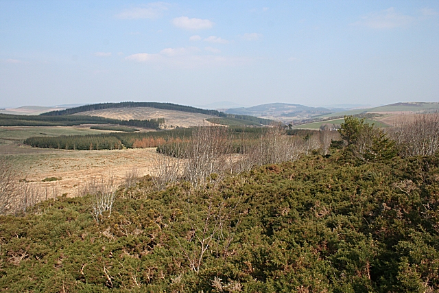
Image: © Anne Burgess Taken: 2 Apr 2009
The whins in the foreground will be much more colourful in a few weeks' time. The view encompasses Brown Hill (the one in NJ46380) on the left and Bin Hill near Huntly further away and to the right, and Knock Hill is faintly visible between them in the far distance. The extreme right skyline is Clashmach Hill.
Images are licensed for reuse under creativecommons.org/licenses/by-sa/2.0
Image Location
Latitude
57.42402
Longitude
-2.885324