Aylesford station - footbridge and southbound platform
Introduction
The photograph on this page of Aylesford station - footbridge and southbound platform by Stephen Craven as part of the Geograph project.
The Geograph project started in 2005 with the aim of publishing, organising and preserving representative images for every square kilometre of Great Britain, Ireland and the Isle of Man.

There are currently over 7.5m images from over 14,400 individuals and you can help contribute to the project by visiting https://www.geograph.org.uk
Aylesford station - footbridge and southbound platform
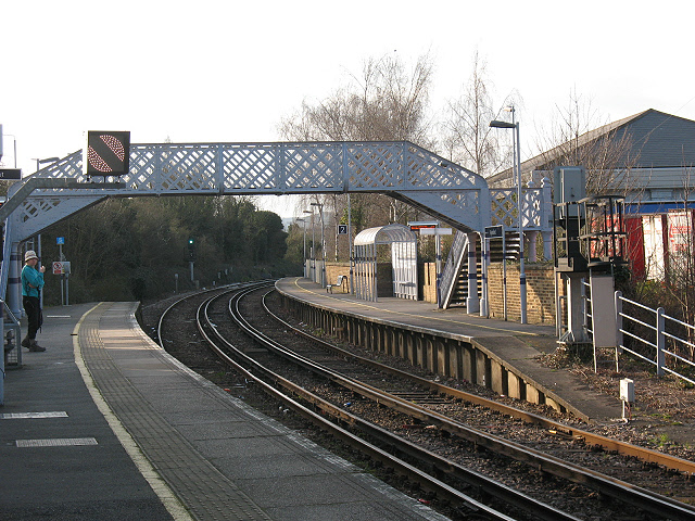
Image: © Stephen Craven Taken: 22 Mar 2009
The station platforms at Aylesford are staggered, and linked by a footbridge near the end of each platform. The line follows the twists and turns of the Medway valley - at this point the line is running almost east/west but it makes more sense to refer to the platforms as northbound (left of this view) and southbound (right). The station also straddles the grid line, so other photos of it are in Image
Images are licensed for reuse under creativecommons.org/licenses/by-sa/2.0
Image Location
Latitude
51.301444
Longitude
0.465647