Verwood: post office and postbox № BH31 200
Introduction
The photograph on this page of Verwood: post office and postbox № BH31 200 by Chris Downer as part of the Geograph project.
The Geograph project started in 2005 with the aim of publishing, organising and preserving representative images for every square kilometre of Great Britain, Ireland and the Isle of Man.

There are currently over 7.5m images from over 14,400 individuals and you can help contribute to the project by visiting https://www.geograph.org.uk
Verwood: post office and postbox № BH31 200
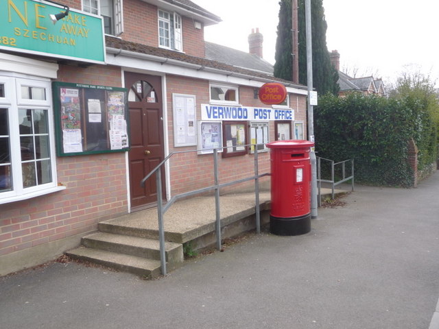
Image: © Chris Downer Taken: 29 Mar 2009
Verwood's post office is close to the main crossroads. The postbox is an Elizabeth II-reign, double-aperture box and it is emptied finally at 5:30pm on weekdays and at 11:30am on Saturdays. These are the latest collections of the town's fifteen postboxes.
Images are licensed for reuse under creativecommons.org/licenses/by-sa/2.0
Image Location
Latitude
50.880521
Longitude
-1.879269