Former M&SWR trackbed, Marlborough
Introduction
The photograph on this page of Former M&SWR trackbed, Marlborough by Brian Robert Marshall as part of the Geograph project.
The Geograph project started in 2005 with the aim of publishing, organising and preserving representative images for every square kilometre of Great Britain, Ireland and the Isle of Man.

There are currently over 7.5m images from over 14,400 individuals and you can help contribute to the project by visiting https://www.geograph.org.uk
Former M&SWR trackbed, Marlborough
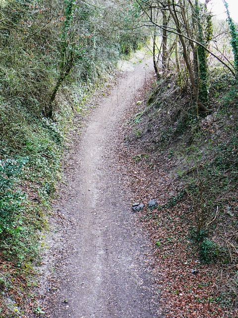
Image: © Brian Robert Marshall Taken: 28 Mar 2009
The trackbed is now a cycle route. The line started life as part of the Swindon, Marlborough and Andover (SMAR) railway in the 19th century. The line was subsequently extended to as far north as Cheltenham and was re-named the Midland and South Western Railway. In the grouping of 1923 it was taken over by the Great Western Railway. The line closed to passenger traffic in September 1961. In this view the line is seen as it heads south and then west around the eastern edge of Marlborough. The next station stop was Marlborough Low Level.
Images are licensed for reuse under creativecommons.org/licenses/by-sa/2.0
Image Location
Latitude
51.418133
Longitude
-1.712774