Kirkby Town Centre
Introduction
The photograph on this page of Kirkby Town Centre by Sue Adair as part of the Geograph project.
The Geograph project started in 2005 with the aim of publishing, organising and preserving representative images for every square kilometre of Great Britain, Ireland and the Isle of Man.

There are currently over 7.5m images from over 14,400 individuals and you can help contribute to the project by visiting https://www.geograph.org.uk
Kirkby Town Centre
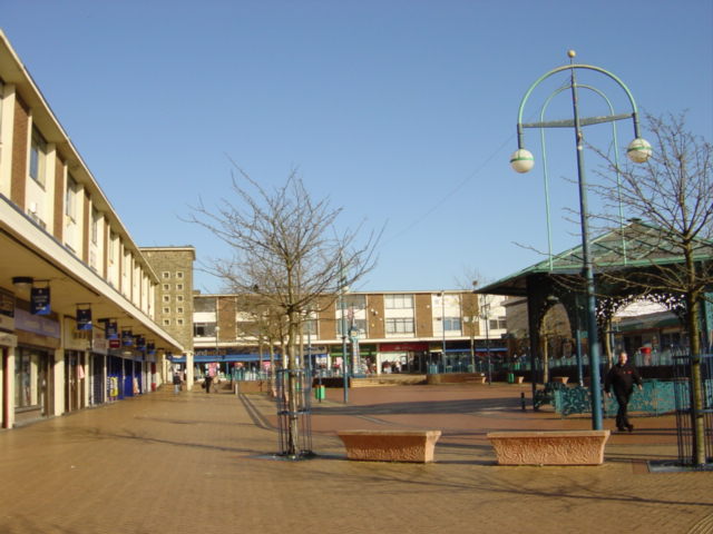
Image: © Sue Adair Taken: 15 Feb 2006
Looking north from Newtown Gardens to Kirkby town centre. The "Newtown" (remember Z cars?) of Kirkby owes its being to the closure of the Royal Ordnance Factory in 1946 when the Government suggested to Liverpool City Council that making use of some of the thousand buildings and creating a large trading/industrial estate would provide jobs for redundant workers and the demobbed. The trading estate steadily expanded through the 1950s and 1960s to become one of the largest in the country, at its peak in 1971, the estate employed over 26,000 people. A model town of 10,000 houses was constructed, mainly as an overspill for Liverpool, on what was once agricultural land and the modest population of 3,000 expanded to 50,000 by 1961. New facilities to cater for the growing population included a variety of shops, banks and business premises, a library and a market, probably the only surviving outdoor market on Merseyside.
Images are licensed for reuse under creativecommons.org/licenses/by-sa/2.0
Image Location
Latitude
53.480821
Longitude
-2.887496