Dundee: Howff graveyard railings
Introduction
The photograph on this page of Dundee: Howff graveyard railings by Martyn Gorman as part of the Geograph project.
The Geograph project started in 2005 with the aim of publishing, organising and preserving representative images for every square kilometre of Great Britain, Ireland and the Isle of Man.

There are currently over 7.5m images from over 14,400 individuals and you can help contribute to the project by visiting https://www.geograph.org.uk
Dundee: Howff graveyard railings
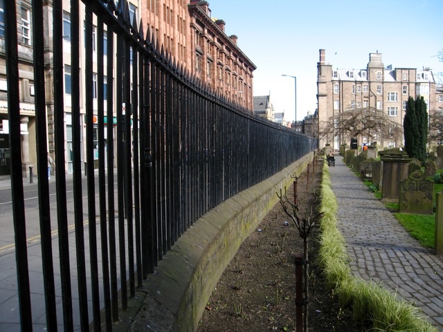
Image: © Martyn Gorman Taken: 23 Mar 2009
This burial ground was formerly part of the lands of the Greyfriars granted by Mary Queen of Scots to the burgh of Dundee in 1564. The name Howff (meeting place) derives from the fact that the Dundee Incorporated Trades met here until 1776. The 1828 wall and railings alongside Meadowside are a listed structure and are the work of David Neave. They were functional as well as attractive, being designed to keep out grave robbers who stole corpses for sale to the local anatomists.
Images are licensed for reuse under creativecommons.org/licenses/by-sa/2.0
Image Location
Latitude
56.461819
Longitude
-2.973807