St John the Baptist
Introduction
The photograph on this page of St John the Baptist by Sue Adair as part of the Geograph project.
The Geograph project started in 2005 with the aim of publishing, organising and preserving representative images for every square kilometre of Great Britain, Ireland and the Isle of Man.

There are currently over 7.5m images from over 14,400 individuals and you can help contribute to the project by visiting https://www.geograph.org.uk
St John the Baptist
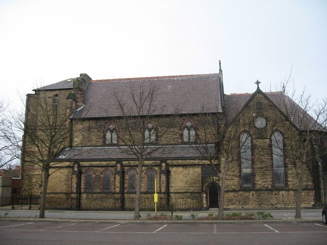
Image: © Sue Adair Taken: 24 Mar 2009
St John the Baptist in Earlestown is a large church but looks somewhat unbalanced probably due to the fact that the original plans had included a clock tower which had to be curtailed due to lack of funding. On August 4, 1875,the foundation stone was laid by Mrs. W J. Legh, wife of the Lord of the Manor, who had donated the land in Market Street. The new Church was consecrated on January 6, 1879.
Images are licensed for reuse under creativecommons.org/licenses/by-sa/2.0
Image Location
Latitude
53.453253
Longitude
-2.644923