Solar Panels & Wind Generator
Introduction
The photograph on this page of Solar Panels & Wind Generator by David Stowell as part of the Geograph project.
The Geograph project started in 2005 with the aim of publishing, organising and preserving representative images for every square kilometre of Great Britain, Ireland and the Isle of Man.

There are currently over 7.5m images from over 14,400 individuals and you can help contribute to the project by visiting https://www.geograph.org.uk
Solar Panels & Wind Generator
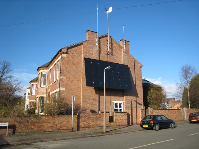
Image: © David Stowell Taken: 23 Mar 2009
The huge panel on this house is a recently installed photovoltaic array to complement the wind turbine (the first in the area under recent regulations) attached to the end of the building. The size of the panel caused some controversy when it received planning approval as many shops and business premises claimed that their applications for much smaller advertising displays were routinely refused.
Images are licensed for reuse under creativecommons.org/licenses/by-sa/2.0
Image Location
Latitude
52.296601
Longitude
-1.532198