Old railway at Par
Introduction
The photograph on this page of Old railway at Par by John Gibson as part of the Geograph project.
The Geograph project started in 2005 with the aim of publishing, organising and preserving representative images for every square kilometre of Great Britain, Ireland and the Isle of Man.

There are currently over 7.5m images from over 14,400 individuals and you can help contribute to the project by visiting https://www.geograph.org.uk
Old railway at Par
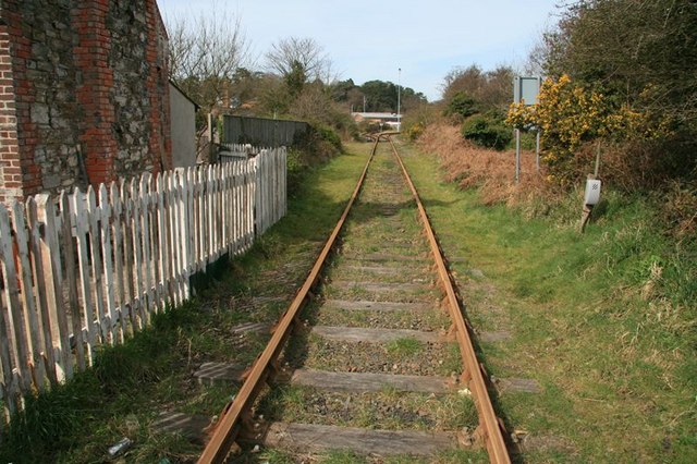
Image: © John Gibson Taken: 16 Mar 2009
A view taken from the old level crossing just by the junction of the A3082 Par Green with Harbour Road, Par, and looking back up the spur in the direction of the main line. The spur runs to the China Clay Dries by Par docks but, as the china clay industry contracts, so the ripples spread outwards and this line now appears to have fallen into disuse.
Images are licensed for reuse under creativecommons.org/licenses/by-sa/2.0
Image Location
Latitude
50.350575
Longitude
-4.707779