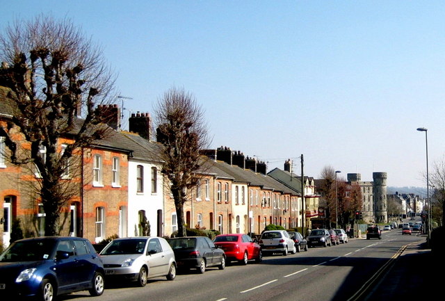
Terraced houses - Bridport Road
Introduction
The photograph on this page of Terraced houses - Bridport Road by Sarah Smith as part of the Geograph project.
The Geograph project started in 2005 with the aim of publishing, organising and preserving representative images for every square kilometre of Great Britain, Ireland and the Isle of Man.
There are currently over 7.5m images from over 14,400 individuals and you can help contribute to the project by visiting https://www.geograph.org.uk

Image: © Sarah Smith Taken: 21 Mar 2009
Near the end of the Bridport Road the Military Museum is visible and the start of High West Street which is the other side of the Top o'Town roundabout. The trees along the road have been well-pruned in municipal fashion and used to extend as a line from the Military Museum becoming an avenue on leaving the town and stretching out into the countryside to beyond where Poundbury is today.
Image Location


