Stannington and Liberty Hill
Introduction
The photograph on this page of Stannington and Liberty Hill by Martin Speck as part of the Geograph project.
The Geograph project started in 2005 with the aim of publishing, organising and preserving representative images for every square kilometre of Great Britain, Ireland and the Isle of Man.

There are currently over 7.5m images from over 14,400 individuals and you can help contribute to the project by visiting https://www.geograph.org.uk
Stannington and Liberty Hill
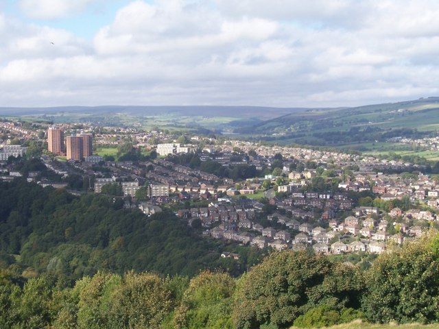
Image: © Martin Speck Taken: 6 Oct 2008
The view from Stannington View Rd looking out over Stannington, Liberty Hill with the Loxley Valley in the distance. It was down this valley that the flood-water surged when the Dale Dyke dam burst on 11 March 1864 causing Britain's worst ever peace-time disaster in terms of fatalities. The dam just visible in the valley is Damflask.
Images are licensed for reuse under creativecommons.org/licenses/by-sa/2.0
Image Location
Latitude
53.393145
Longitude
-1.533952