Ruined Windmill, Glenglassaugh
Introduction
The photograph on this page of Ruined Windmill, Glenglassaugh by Christopher Gillan as part of the Geograph project.
The Geograph project started in 2005 with the aim of publishing, organising and preserving representative images for every square kilometre of Great Britain, Ireland and the Isle of Man.

There are currently over 7.5m images from over 14,400 individuals and you can help contribute to the project by visiting https://www.geograph.org.uk
Ruined Windmill, Glenglassaugh
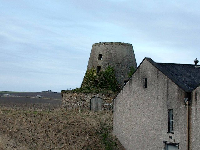
Image: © Christopher Gillan Taken: 12 Feb 2006
The remains of a windmill at Glenglassaugh Distillery. The remains predate the distillery, which was opened between 1873 and 1875. The land on which the distillery was erected was called "Craigs Mills" after the three mills which were situated there. I understand that the remains may be referred to locally as "The cup and saucer"! The building in the foreground is part of the bonded warehouse complex at the distillery.
Images are licensed for reuse under creativecommons.org/licenses/by-sa/2.0
Image Location
Latitude
57.678993
Longitude
-2.739444