"The Fort"
Introduction
The photograph on this page of "The Fort" by Brian Shaw as part of the Geograph project.
The Geograph project started in 2005 with the aim of publishing, organising and preserving representative images for every square kilometre of Great Britain, Ireland and the Isle of Man.

There are currently over 7.5m images from over 14,400 individuals and you can help contribute to the project by visiting https://www.geograph.org.uk
"The Fort"
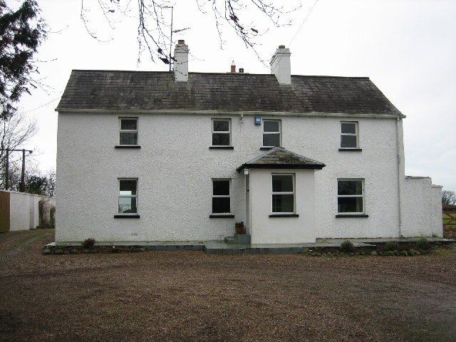
Image: © Brian Shaw Taken: 13 Feb 2006
There has been an addition on the left-hand side since I lived here about sixty-five years ago. It's also been painted white. In those days there was no electricity, and water was gathered into a 10,000 gallon water tank on the roof at the back.
Images are licensed for reuse under creativecommons.org/licenses/by-sa/2.0
Image Location
Latitude
54.366065
Longitude
-6.439179