Bennybeg Craig
Introduction
The photograph on this page of Bennybeg Craig by Dr Richard Murray as part of the Geograph project.
The Geograph project started in 2005 with the aim of publishing, organising and preserving representative images for every square kilometre of Great Britain, Ireland and the Isle of Man.

There are currently over 7.5m images from over 14,400 individuals and you can help contribute to the project by visiting https://www.geograph.org.uk
Bennybeg Craig
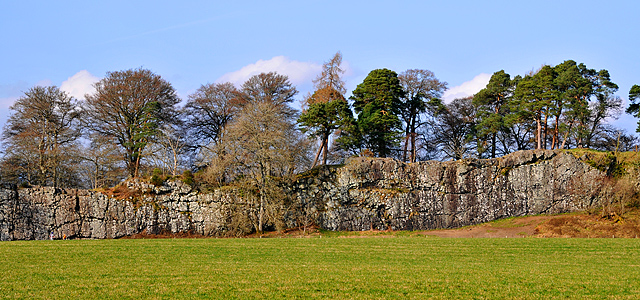
Image: © Dr Richard Murray Taken: 19 Mar 2009
This is one of a series of volcanic dykes caused by molten rock thrusting up through cracks in the crustal rocks: The solidified upwelling rock (in this case quartz-dolerite) is harder than the surrounding bedrock and weathers less over time leaving a cliff or wall of dolerite - Ideal for rock climbing.
Images are licensed for reuse under creativecommons.org/licenses/by-sa/2.0
Image Location
Latitude
56.348459
Longitude
-3.842115