Meersbrook and beyond
Introduction
The photograph on this page of Meersbrook and beyond by Martin Speck as part of the Geograph project.
The Geograph project started in 2005 with the aim of publishing, organising and preserving representative images for every square kilometre of Great Britain, Ireland and the Isle of Man.

There are currently over 7.5m images from over 14,400 individuals and you can help contribute to the project by visiting https://www.geograph.org.uk
Meersbrook and beyond
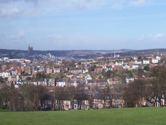
Image: © Martin Speck Taken: 9 Mar 2009
Meersbrook Park Road and the Meersbrook area as seen from Meersbrook Park. Beyond is Sheffield city centre. Joseph Mallord William Turner (1775-1851) painted a similar view circa 1797 http://www.tate.org.uk/art/artworks/turner-sheffield-from-derbyshire-lane-tw0841 from nearby Derbyshire Lane. Turner's painting was reproduced as an engraving, http://www.tate.org.uk/art/artworks/turner-sheffield-engraved-by-walker-t05904 published in 1798 by Walker. The tower to the right of the spire, visible in Turner's painting and Walker's engraving is St Paul's church, which was demolished in 1938. This stood on what is now the Peace Garden on Pinstone Street. St Paul's City Lofts building, under construction in the 2009 photograph and seen on the left occupies a site very close to the old St Paul's Church. In his painting Sheffield from the South East, dated 1836 William Cowen painted a similar view, this time from nearby Heeley Bank Road. A copy of Cowen's painting can be found in the slideshow at this http://news.bbc.co.uk/local/sheffield/hi/people_and_places/arts_and_culture/newsid_8652000/8652516.stm . For another photograph linked to an artist's depiction of Sheffield see Image
Images are licensed for reuse under creativecommons.org/licenses/by-sa/2.0
Image Location
Latitude
53.354229
Longitude
-1.470526