Hayes Farm Windmill, Sully.
Introduction
The photograph on this page of Hayes Farm Windmill, Sully. by Mick Lobb as part of the Geograph project.
The Geograph project started in 2005 with the aim of publishing, organising and preserving representative images for every square kilometre of Great Britain, Ireland and the Isle of Man.

There are currently over 7.5m images from over 14,400 individuals and you can help contribute to the project by visiting https://www.geograph.org.uk
Hayes Farm Windmill, Sully.
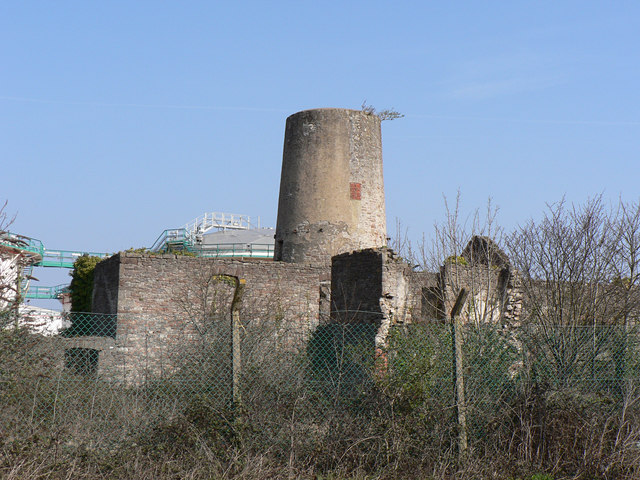
Image: © Mick Lobb Taken: 21 Mar 2009
Listed by CADW as a circular rubble tower containing original wooden machinery including three of four mill stones in situ. The ruin is behind the wire fence surrounding the industrial complex that includes a power station and chemical/plastics factory, some of its infrastructure is visible behind the mill. Hopefully this will protect it from further deterioration resulting from vandalism and offering the possibility of some kind of protective restoration. On the other hand of course it might seem to occupiers of the site to be of no interest and an impediment to expansion and it will be demolished despite its status! It has happened before!
Images are licensed for reuse under creativecommons.org/licenses/by-sa/2.0
Image Location
Latitude
51.40333
Longitude
-3.236288