Coalhouse, Rope Barn Farm near Blanchland
Introduction
The photograph on this page of Coalhouse, Rope Barn Farm near Blanchland by Les Hull as part of the Geograph project.
The Geograph project started in 2005 with the aim of publishing, organising and preserving representative images for every square kilometre of Great Britain, Ireland and the Isle of Man.

There are currently over 7.5m images from over 14,400 individuals and you can help contribute to the project by visiting https://www.geograph.org.uk
Coalhouse, Rope Barn Farm near Blanchland
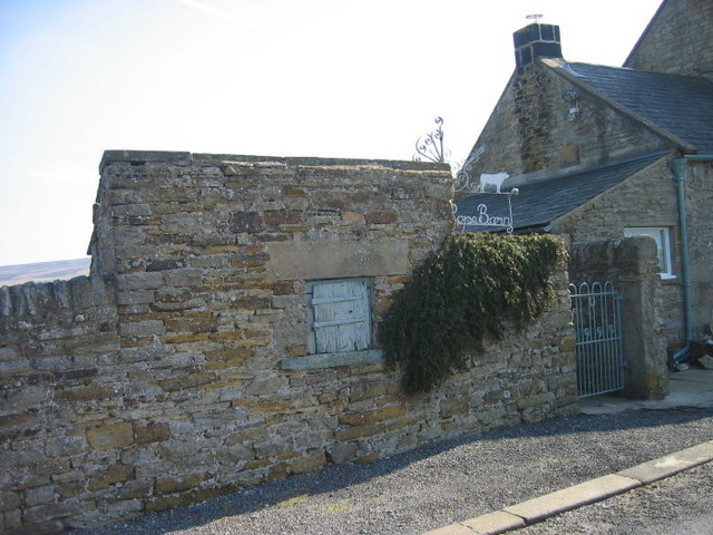
Image: © Les Hull Taken: 18 Mar 2009
This building set apart from the main building is a coalhouse and was common in urban and rural areas. When coal was being delivered the small wooden door opened and the coal was off loaded into the hole. On the other side would be a full door so the occupants of the house could get the cola for their fires.
Images are licensed for reuse under creativecommons.org/licenses/by-sa/2.0
Image Location
Latitude
54.845159
Longitude
-2.052292