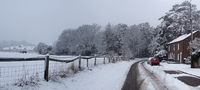
Park Road, Tring in the snow
Introduction
The photograph on this page of Park Road, Tring in the snow by Rob Farrow as part of the Geograph project.
The Geograph project started in 2005 with the aim of publishing, organising and preserving representative images for every square kilometre of Great Britain, Ireland and the Isle of Man.
There are currently over 7.5m images from over 14,400 individuals and you can help contribute to the project by visiting https://www.geograph.org.uk

Image: © Rob Farrow Taken: 5 Feb 2009
Park Road in Tring is a quiet residential street with houses only on the northern side. Fields separate its southern side from the A41 Tring Bypass (formerly the A41(M)). As can be seen, a little further on there are some buildings on this southern side, which are farm buildings, now largely converted to residential properties. It is quite interesting to look at the map of Tring in relation to the Roman road, Akeman Street, which runs WNW/ESE from Aylesbury through Tring towards London. It is clear that the original course of this road used what is now Park Road and Park Street and crossed Tring Park immediately to the south of Image] (though obviously before that was built). The deviation of the road through Tring's High Street creating a kink in the otherwise straight Roman road. Confusingly, where Park Road becomes Park Street at Image] the road joining them back to the High Street at 90º is called "Akeman Street" though it is obvious that this was not its original route.

