Madey Mill
Introduction
The photograph on this page of Madey Mill by Derek Harper as part of the Geograph project.
The Geograph project started in 2005 with the aim of publishing, organising and preserving representative images for every square kilometre of Great Britain, Ireland and the Isle of Man.

There are currently over 7.5m images from over 14,400 individuals and you can help contribute to the project by visiting https://www.geograph.org.uk
Madey Mill
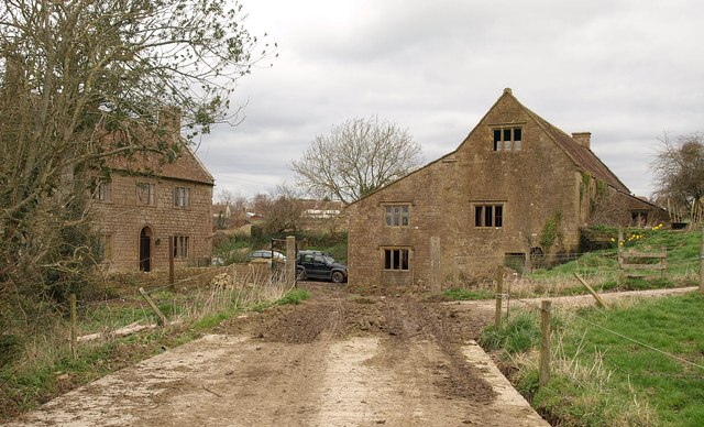
Image: © Derek Harper Taken: 13 Mar 2009
"Probably one of 2 Domesday mills - this mill known as Madey mill since C14; in 1592 was coupled with a horse mill; it passed to the Manor in 1637, and was probably rebuilt soon after." http://www.imagesofengland.org.uk/details/default.aspx?id=423589 for further details. On the left is the C18 Madey Mill Farmhouse - see http://www.imagesofengland.org.uk/Details/Default.aspx?id=423588&mode=adv . Seen from footpath Y16/17A.
Images are licensed for reuse under creativecommons.org/licenses/by-sa/2.0
Image Location
Latitude
50.968392
Longitude
-2.760001