Hawthorn Avenue, Hull
Introduction
The photograph on this page of Hawthorn Avenue, Hull by Paul Glazzard as part of the Geograph project.
The Geograph project started in 2005 with the aim of publishing, organising and preserving representative images for every square kilometre of Great Britain, Ireland and the Isle of Man.

There are currently over 7.5m images from over 14,400 individuals and you can help contribute to the project by visiting https://www.geograph.org.uk
Hawthorn Avenue, Hull
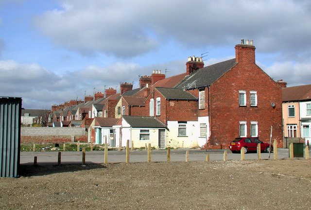
Image: © Paul Glazzard Taken: 17 Mar 2009
The backs of Nos. 112-164 Hawthorn Avenue, looking north across the short road to the site of the old corporation workshops. These terraced houses have been earmarked by the city council for acquisition and demolition between now and 2011. The cleared patch in the foreground is where Nos. 170-178 and the Eureka Club once stood, which have already been knocked down. Nos. 166-168 were presumably demolished much earlier to make way for the road.
Images are licensed for reuse under creativecommons.org/licenses/by-sa/2.0
Image Location
Latitude
53.73952
Longitude
-0.381949