East Street, Ashburton
Introduction
The photograph on this page of East Street, Ashburton by Derek Harper as part of the Geograph project.
The Geograph project started in 2005 with the aim of publishing, organising and preserving representative images for every square kilometre of Great Britain, Ireland and the Isle of Man.

There are currently over 7.5m images from over 14,400 individuals and you can help contribute to the project by visiting https://www.geograph.org.uk
East Street, Ashburton
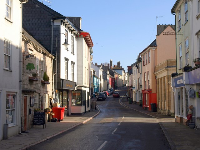
Image: © Derek Harper Taken: 9 Mar 2009
The street climbs gently away from the town centre, passing the junction with Image on the right. To the left is the Royal Oak, an old (indeed, medieval http://www.imagesofengland.org.uk/Details/Default.aspx?id=376007&mode=adv ) pub contrasting with the plaster facades on most other frontages. Next, jutting out more with deep eaves, is the Gospel Hall http://www.imagesofengland.org.uk/Details/Default.aspx?id=376009&mode=adv and http://www.imagesofengland.org.uk/Details/Default.aspx?id=376010&mode=adv
Images are licensed for reuse under creativecommons.org/licenses/by-sa/2.0
Image Location
Latitude
50.515631
Longitude
-3.756001