St Lawrence's Tower, Ashburton
Introduction
The photograph on this page of St Lawrence's Tower, Ashburton by Derek Harper as part of the Geograph project.
The Geograph project started in 2005 with the aim of publishing, organising and preserving representative images for every square kilometre of Great Britain, Ireland and the Isle of Man.

There are currently over 7.5m images from over 14,400 individuals and you can help contribute to the project by visiting https://www.geograph.org.uk
St Lawrence's Tower, Ashburton
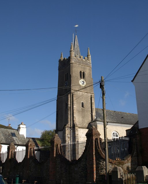
Image: © Derek Harper Taken: 9 Mar 2009
"Although the tower is of late 15th or early 16th century date, and the nave mostly rebuilt in the 1740s, some of its fabric dates back to the late 13th century and is part of the Chantry Chapel given to the town by Bishop Stapledon in 1314. Its historic significance is therefore considerable, not least because it may have been part of a Bishop’s Palace and was converted to a Grammar School in 1593." http://www.dartmoor-npa.gov.uk/li-caaashb-04.pdf A detailed architectural description is at http://www.imagesofengland.org.uk/Details/Default.aspx?id=376146&mode=adv . Additionally listed are the gate piers and boundary wall in the foreground, probably mid-C18 - http://www.imagesofengland.org.uk/Details/Default.aspx?id=376147&mode=adv .
Images are licensed for reuse under creativecommons.org/licenses/by-sa/2.0
Image Location
Latitude
50.515113
Longitude
-3.754571