Stockport, 1960
Introduction
The photograph on this page of Stockport, 1960 by Geoff Royle as part of the Geograph project.
The Geograph project started in 2005 with the aim of publishing, organising and preserving representative images for every square kilometre of Great Britain, Ireland and the Isle of Man.

There are currently over 7.5m images from over 14,400 individuals and you can help contribute to the project by visiting https://www.geograph.org.uk
Stockport, 1960
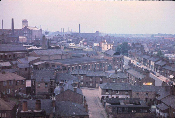
Image: © Geoff Royle Taken: Unknown
This photograph was taken from the tower of Pendlebury Hall. Centre right is the junction of Gordon Street and Lancashire Hill. The Albion flour mill is upper left, and the Reddish cotton mills can be seen in the distance. In the meantime most the Victorian terraced houses here have been cleared.
Images are licensed for reuse under creativecommons.org/licenses/by-sa/2.0
Image Location
Latitude
53.416597
Longitude
-2.159896