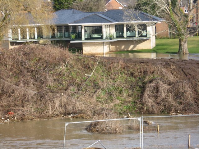
House near the Stour, Canford Bridge
Introduction
The photograph on this page of House near the Stour, Canford Bridge by John Palmer as part of the Geograph project.
The Geograph project started in 2005 with the aim of publishing, organising and preserving representative images for every square kilometre of Great Britain, Ireland and the Isle of Man.
There are currently over 7.5m images from over 14,400 individuals and you can help contribute to the project by visiting https://www.geograph.org.uk

Image: © John Palmer Taken: 11 Feb 2009
This new £1.25 million house was built recently in Station Road, Wimborne, close to the downstream side of Canford Bridge. Unfortunately it is rather close to the river, and floodwaters reached across the lawn to the brickwork on the day of the photograph (height 355) and on the previous day. The wet mark on the wall shows that during the night the peak height of the flood was 376. This was almost the highest flood for 6 years, see records of river levels on this http://www.eyemead.com/LEVELS.htm

