Frankwell, Shrewsbury
Introduction
The photograph on this page of Frankwell, Shrewsbury by Stephen McKay as part of the Geograph project.
The Geograph project started in 2005 with the aim of publishing, organising and preserving representative images for every square kilometre of Great Britain, Ireland and the Isle of Man.

There are currently over 7.5m images from over 14,400 individuals and you can help contribute to the project by visiting https://www.geograph.org.uk
Frankwell, Shrewsbury
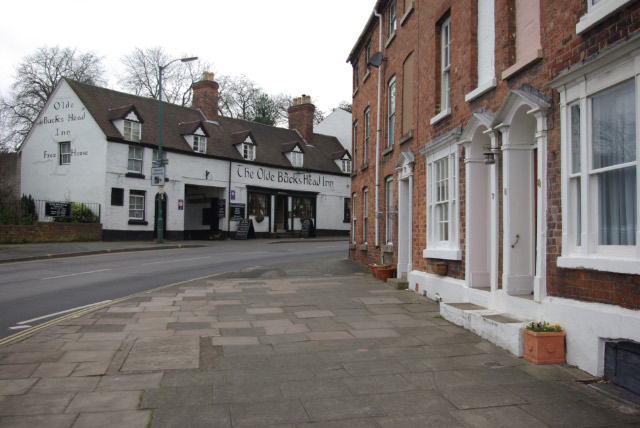
Image: © Stephen McKay Taken: 7 Mar 2009
Frankwell is both the name of this street and the surrounding district, immediately across the Welsh Bridge from Shrewsbury town centre. The area was first developed in Norman times and by the 17th century had become a centre for free trades - lying outside the jurisdiction of the Lord of Shrewsbury Castle. It is nowadays a more mundane suburb, but there still remain sufficient buildings of interest to justify its status as a conservation area.
Images are licensed for reuse under creativecommons.org/licenses/by-sa/2.0
Image Location
Latitude
52.711936
Longitude
-2.762417