Livermead Head
Introduction
The photograph on this page of Livermead Head by Derek Harper as part of the Geograph project.
The Geograph project started in 2005 with the aim of publishing, organising and preserving representative images for every square kilometre of Great Britain, Ireland and the Isle of Man.

There are currently over 7.5m images from over 14,400 individuals and you can help contribute to the project by visiting https://www.geograph.org.uk
Livermead Head
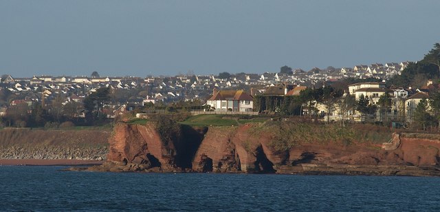
Image: © Derek Harper Taken: 8 Mar 2009
The caves and clefts in the red sandstone headland only become visible from across water - in this case, from the end of Image, over a kilometre away. On the right is The Headlands, a block of 34 flats.
Images are licensed for reuse under creativecommons.org/licenses/by-sa/2.0
Image Location
Latitude
50.452967
Longitude
-3.545193