Strathblane and Ben Lomond from the air
Introduction
The photograph on this page of Strathblane and Ben Lomond from the air by Thomas Nugent as part of the Geograph project.
The Geograph project started in 2005 with the aim of publishing, organising and preserving representative images for every square kilometre of Great Britain, Ireland and the Isle of Man.

There are currently over 7.5m images from over 14,400 individuals and you can help contribute to the project by visiting https://www.geograph.org.uk
Strathblane and Ben Lomond from the air
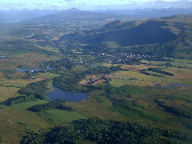
Image: © Thomas Nugent Taken: 30 Jul 2007
Loch Ardinning and Muirhouse quarry are in the foreground, with Strathblane and Blanefield in the centre. Ben Lomond is prominent in the distance, with part of Loch Lomond visible to its left. Viewed from a Glasgow Airport bound Boeing 747.
Images are licensed for reuse under creativecommons.org/licenses/by-sa/2.0
Image Location
Latitude
55.984577
Longitude
-4.303455