Drumard Road.
Introduction
The photograph on this page of Drumard Road. by William England as part of the Geograph project.
The Geograph project started in 2005 with the aim of publishing, organising and preserving representative images for every square kilometre of Great Britain, Ireland and the Isle of Man.

There are currently over 7.5m images from over 14,400 individuals and you can help contribute to the project by visiting https://www.geograph.org.uk
Drumard Road.
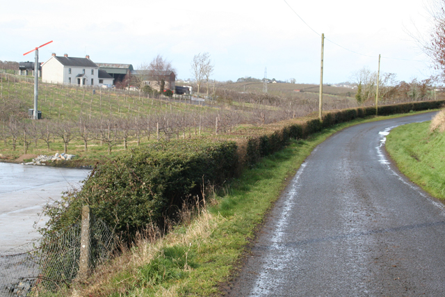
Image: © William England Taken: 9 Mar 2009
In the left of the picture is a Wind Machine at Holly Farm. It is used for frost protection of the bramley apple orchards during blossom time. It is driven by a 152 HP diesel engine and its function is to draw warmer air from the inversion layer and distribute it through the tree canopy, hence reducing the possibility of frost damage.
Images are licensed for reuse under creativecommons.org/licenses/by-sa/2.0
Image Location
Latitude
54.403006
Longitude
-6.51878