River Mole at Kinnersley Manor
Introduction
The photograph on this page of River Mole at Kinnersley Manor by Nigel Cox as part of the Geograph project.
The Geograph project started in 2005 with the aim of publishing, organising and preserving representative images for every square kilometre of Great Britain, Ireland and the Isle of Man.

There are currently over 7.5m images from over 14,400 individuals and you can help contribute to the project by visiting https://www.geograph.org.uk
River Mole at Kinnersley Manor
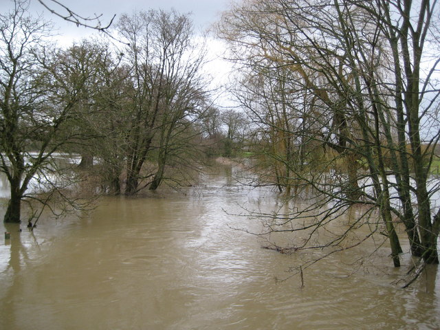
Image: © Nigel Cox Taken: 19 Jan 2009
Flooding of farmland along the banks of the River Mole is a regular occurrence along this reach of the river. Here the river normally flows in a channel straight down the middle of the photograph between the trees, and away from the photographer, but a night of heavy rain coupled with saturated ground was enough for it to burst its banks on either side. Compare this with Image for a photograph of benign conditions taken from the same viewpoint on the Kinnersley Manor access bridge.
Images are licensed for reuse under creativecommons.org/licenses/by-sa/2.0
Image Location
Latitude
51.201612
Longitude
-0.194315