Courteney Gate
Introduction
The photograph on this page of Courteney Gate by Simon Carey as part of the Geograph project.
The Geograph project started in 2005 with the aim of publishing, organising and preserving representative images for every square kilometre of Great Britain, Ireland and the Isle of Man.

There are currently over 7.5m images from over 14,400 individuals and you can help contribute to the project by visiting https://www.geograph.org.uk
Courteney Gate
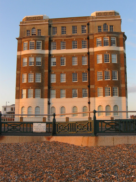
Image: © Simon Carey Taken: 6 Mar 2009
Viewed from the beach at sunset. Built in the 1930s as luxury apartments though they were requisitioned during the war before returning to their original usage. This is the side view as the entrance looks out across the lawns providing the western boundary and viewpoint for their entire length.
Images are licensed for reuse under creativecommons.org/licenses/by-sa/2.0
Image Location
Latitude
50.824189
Longitude
-0.172425