Sadler's Mill, The Causeway, Romsey SO51 8HF
Introduction
The photograph on this page of Sadler's Mill, The Causeway, Romsey SO51 8HF by Ray Lambert as part of the Geograph project.
The Geograph project started in 2005 with the aim of publishing, organising and preserving representative images for every square kilometre of Great Britain, Ireland and the Isle of Man.

There are currently over 7.5m images from over 14,400 individuals and you can help contribute to the project by visiting https://www.geograph.org.uk
Sadler's Mill, The Causeway, Romsey SO51 8HF
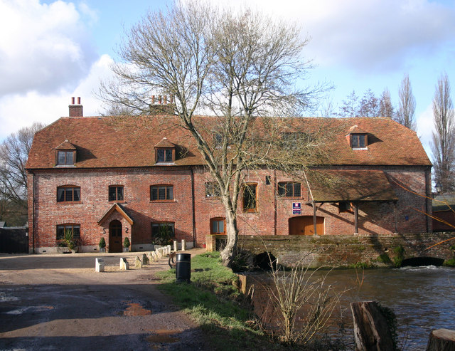
Image: © Ray Lambert Taken: 6 Feb 2008
Sadler's Mill on the Test Way. Rebuilt by the first Lord Palmerston in 1748 and restored over the past three years. The Test Way access is opposite the white bollards in the photograph. The Mill is generally referred to as Saddlers Mill with two D's this is incorrect. The name arose from Richard Sadler who is to be found in the Hearth Tax returns of 1665. Reference LTVAS Group publication 'Romsey Mills and Waterways'.
Images are licensed for reuse under creativecommons.org/licenses/by-sa/2.0
Image Location


Leaflet Map data © OpenStreetMap
Latitude
50.986012
Longitude
-1.506734