Royal Oak - Charmouth
Introduction
The photograph on this page of Royal Oak - Charmouth by John M as part of the Geograph project.
The Geograph project started in 2005 with the aim of publishing, organising and preserving representative images for every square kilometre of Great Britain, Ireland and the Isle of Man.

There are currently over 7.5m images from over 14,400 individuals and you can help contribute to the project by visiting https://www.geograph.org.uk
Royal Oak - Charmouth
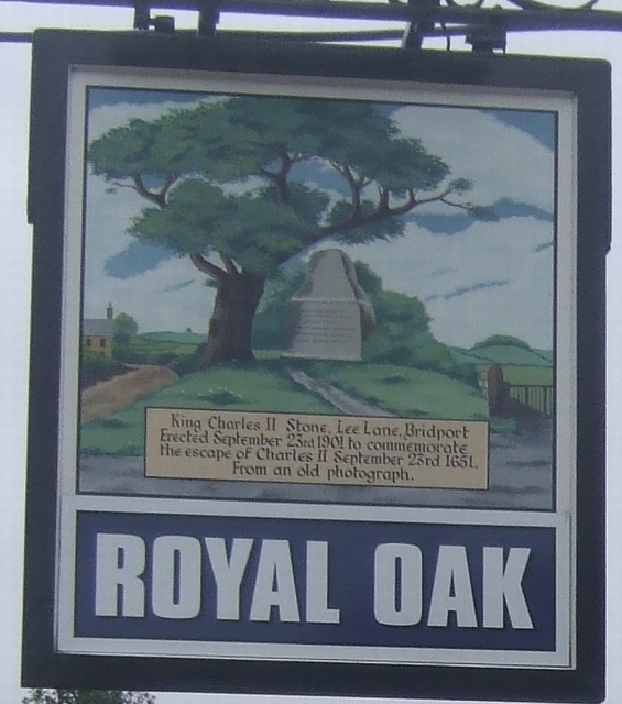
Image: © John M Taken: 25 Feb 2009
Marking the passage of King Charles through nearby Bridport. Charmouth itself features on the 'Monarch's Way' as the first place on the south coast where the king tried to take a boat into exile but was thwarted. Image
Images are licensed for reuse under creativecommons.org/licenses/by-sa/2.0
Image Location
Latitude
50.738319
Longitude
-2.904362