Road bridge and footbridge
Introduction
The photograph on this page of Road bridge and footbridge by Evelyn Simak as part of the Geograph project.
The Geograph project started in 2005 with the aim of publishing, organising and preserving representative images for every square kilometre of Great Britain, Ireland and the Isle of Man.

There are currently over 7.5m images from over 14,400 individuals and you can help contribute to the project by visiting https://www.geograph.org.uk
Road bridge and footbridge
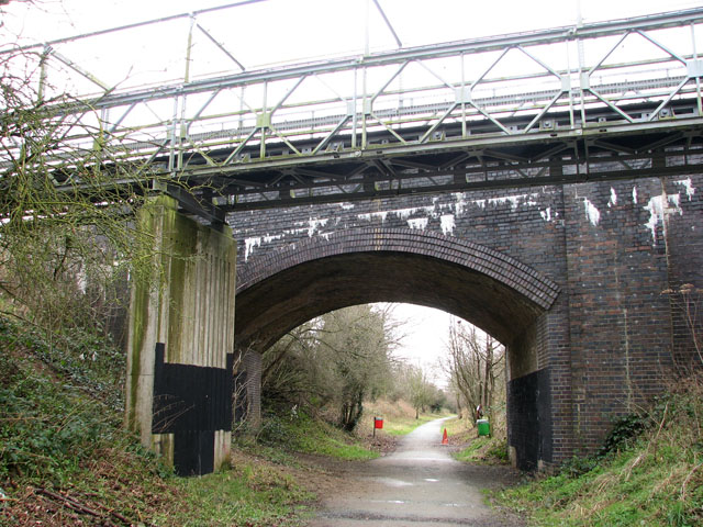
Image: © Evelyn Simak Taken: 4 Mar 2009
The bridge carries Hungate Street over the dismantled railway trackbed which now forms a section of the Marriott's Way. A footbridge runs parallel with the roadbridge. See also > http://www.geograph.org.uk/photo/622378. This section of the Marriott's Way links Norwich Road with Hungate Street and leads to the village of Cawston, further to the west.
Images are licensed for reuse under creativecommons.org/licenses/by-sa/2.0
Image Location
Latitude
52.790255
Longitude
1.249758