Denshaw Milepost
Introduction
The photograph on this page of Denshaw Milepost by David Rogers as part of the Geograph project.
The Geograph project started in 2005 with the aim of publishing, organising and preserving representative images for every square kilometre of Great Britain, Ireland and the Isle of Man.

There are currently over 7.5m images from over 14,400 individuals and you can help contribute to the project by visiting https://www.geograph.org.uk
Denshaw Milepost
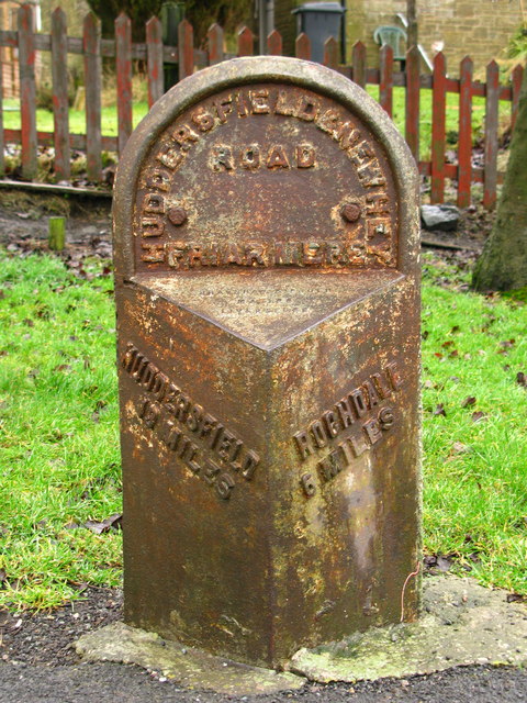
Image: © David Rogers Taken: 27 Feb 2009
By the side of the A640 approaching Denshaw. Friar Mere is also included as the location and refers to one of four hamlets or quarters, called Meres, the others being Quick Mere, Lord's Mere and Shaw Mere. Friar Mere was once an estate belonging to the Black Friars, who had a house, or grange near Delph.
Images are licensed for reuse under creativecommons.org/licenses/by-sa/2.0
Image Location
Latitude
53.593049
Longitude
-2.041358