Jumble of signs, Asheridge
Introduction
The photograph on this page of Jumble of signs, Asheridge by Rob Farrow as part of the Geograph project.
The Geograph project started in 2005 with the aim of publishing, organising and preserving representative images for every square kilometre of Great Britain, Ireland and the Isle of Man.

There are currently over 7.5m images from over 14,400 individuals and you can help contribute to the project by visiting https://www.geograph.org.uk
Jumble of signs, Asheridge
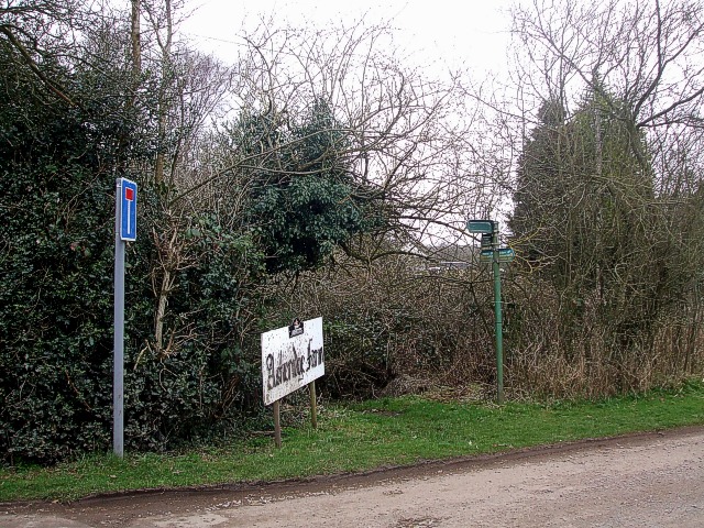
Image: © Rob Farrow Taken: 28 Feb 2009
A juxtaposition of three signs here. The leftmost one informs us that Ashotts Lane comes to a dead-end - as far as vehicles are concerned - a short way ahead, though it continues as a bridleway. This road termination is pretty much where it meets Asheridge Farm, announced by the large, low sign in the middle. The rightmost sign is a multi-pointered footpath sign, much defaced - not necessarily on purpose. The topmost pointer points to the left and indicates the bridleway that runs along Ashotts Lane (see numerous photos in SP9205). The next pointer down is indicating the footpath seen in Image Beneath this are pointers pointing in both directions, one along the footpath and the other along the main lane through Asheridge. This double pointer is showing the route of the Chiltern Heritage Trail.
Images are licensed for reuse under creativecommons.org/licenses/by-sa/2.0
Image Location
Latitude
51.740125
Longitude
-0.653351