The Ballyskeagh High Bridge (6 of 8)
Introduction
The photograph on this page of The Ballyskeagh High Bridge (6 of 8) by Albert Bridge as part of the Geograph project.
The Geograph project started in 2005 with the aim of publishing, organising and preserving representative images for every square kilometre of Great Britain, Ireland and the Isle of Man.

There are currently over 7.5m images from over 14,400 individuals and you can help contribute to the project by visiting https://www.geograph.org.uk
The Ballyskeagh High Bridge (6 of 8)
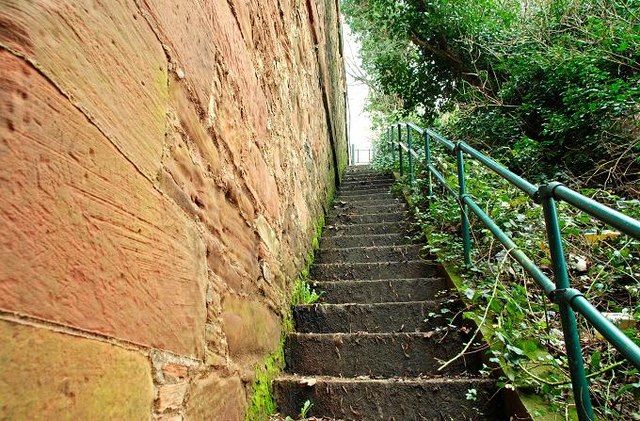
Image: © Albert Bridge Taken: 26 Feb 2009
See Image These closed and fenced steps led from the towpath to the Ballyskeagh Road. The present pedestrian route is via the towpath to McIlroy Park and the road. Continue to Image
Images are licensed for reuse under creativecommons.org/licenses/by-sa/2.0
Image Location
Latitude
54.534149
Longitude
-6.009907