The Ballyskeagh High Bridge (1 of 8)
Introduction
The photograph on this page of The Ballyskeagh High Bridge (1 of 8) by Albert Bridge as part of the Geograph project.
The Geograph project started in 2005 with the aim of publishing, organising and preserving representative images for every square kilometre of Great Britain, Ireland and the Isle of Man.

There are currently over 7.5m images from over 14,400 individuals and you can help contribute to the project by visiting https://www.geograph.org.uk
The Ballyskeagh High Bridge (1 of 8)
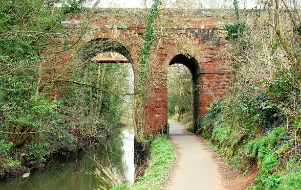
Image: © Albert Bridge Taken: 26 Feb 2009
Image gives the building date. The two-arch bridge crosses the Lagan Navigation (left) and the towpath (right). The road (now called the Ballyskeagh Road) is much higher than the canal – an interesting challenge for a civil engineer 250 years ago. The view is towards Belfast. The towpath here is narrower than elsewhere on the surviving stretches of disused canal. Continue to Image
Images are licensed for reuse under creativecommons.org/licenses/by-sa/2.0
Image Location
Latitude
54.534152
Longitude
-6.010062