Nos 19 and 21, Upper Kirkgate
Introduction
The photograph on this page of Nos 19 and 21, Upper Kirkgate by Mike Kirby as part of the Geograph project.
The Geograph project started in 2005 with the aim of publishing, organising and preserving representative images for every square kilometre of Great Britain, Ireland and the Isle of Man.

There are currently over 7.5m images from over 14,400 individuals and you can help contribute to the project by visiting https://www.geograph.org.uk
Nos 19 and 21, Upper Kirkgate
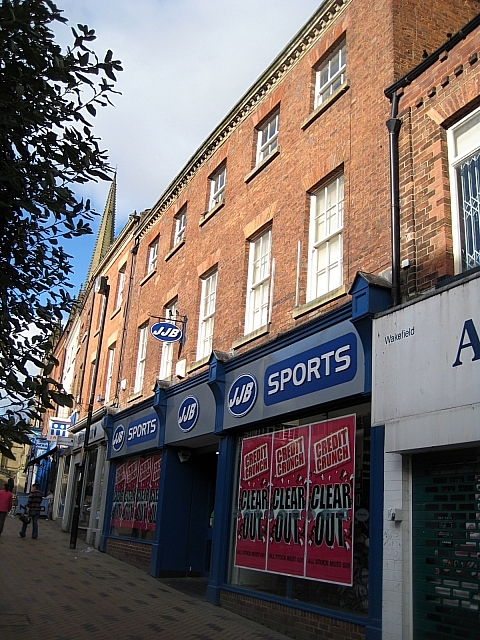
Image: © Mike Kirby Taken: 22 Feb 2009
This grade II listed building dates back to the late C18. It consists a 2-storey 5-bay house, red brick with stone moulded and modillion eaves cornice, with a fairly low pitched, hipped stone-flagged roof. Three original sash windows with glazing bars remain on 2nd floor. A modern shop front has been added.
Images are licensed for reuse under creativecommons.org/licenses/by-sa/2.0
Image Location
Latitude
53.682776
Longitude
-1.495485